Vancouver Island-Central Coast (Zone 6)

Zone Details
Vancouver Island-Central Coast (Zone 6)
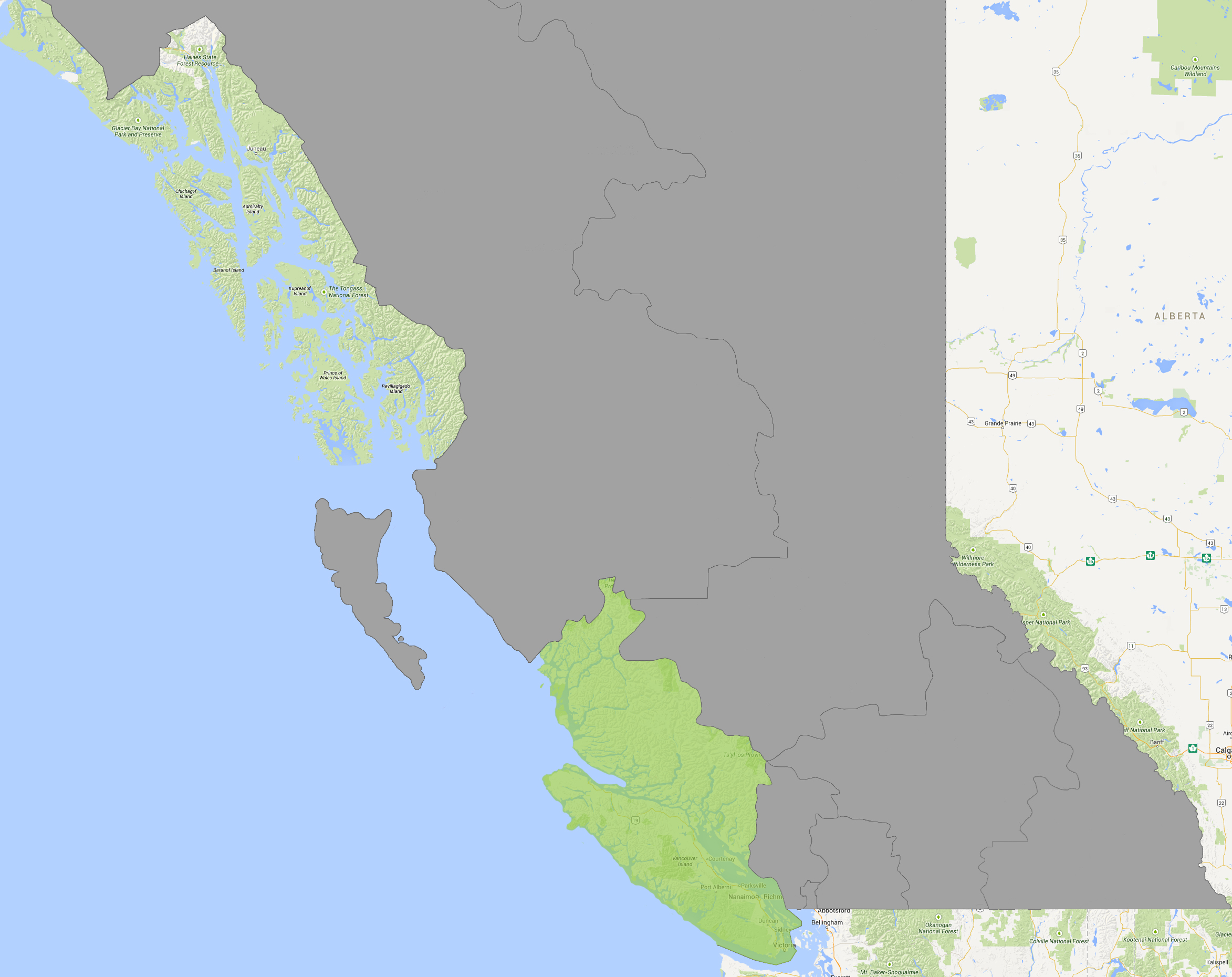
Zone Colour: Light Green
Interactive Map: click here or on the map to the left.
Encompasses the Regional Districts of Alberni-Clayoquot, Capital, Central Coast, Comox-Strathcona, Cowichan Valley, Mount Waddington, Nanaimo, and Powell River. Includes the major centres of the city of Campbell River, the town of Comox, the city of Courtenay, the village of Cumberland, the city of Duncan, the township of Esquimalt, the city of Ladysmith, the city of Nanaimo, the municipality of North Cowichan, the city of Oak Bay, the city of Port Alberni, the district of Port Hardy, the city of Powell River, the district of Saanich, the village of Sayward, the town of Sidney, and the city of Victoria.
Communities in the zone: Alert Bay, Black Creek, Bowser, Brentwood Bay, Buckley Bay, Campbell River, Cassidy, Cedar, Chemainus, Cobble Hill, Colwood, Comox, Coombs, Cortez Island, Courtenay, Cowichan Bay, Crofton, Cumberland, Deep Bay, Denman Island, Duncan, Errington, Esquimalt, Fanny Bay, French Creek, Fulford Harbour, Gabriola Island, Galiano Island, Ganges, Gillies Bay, Gold River, Heriot Bay, Holberg, Honeymoon Bay, Hornby Island, Ladysmith, Lake Cowichan, Langford, Lantzville, Lasqueti Island, Lazo, Lund, Malahat, Mansons Landing, Mayne Island, Merville, Mesachie Lake, Mill Bay, Nanaimo, Nanoose Bay, Parksville, Pender Island, Port Alberni, Port Alice, Port Hardy, Port McNeill, Powell River, Quadra Island, Qualicum, Qualicum Bay, Qualicum Beach, Quathiaski Cove, Refuge Cove, Royston, Saanich, Saanichton, Saltspring, Saltspring Island, Saratoga Beach, Saturna Island, Sayward, Shawnigan Lake, Sidney, Sointula, Sooke, Stuart Island, Tahsis, Tofino, Ucluelet, Union Bay, Vananda, Victoria, Westholme, Whaletown, Woss, Youbou.


